


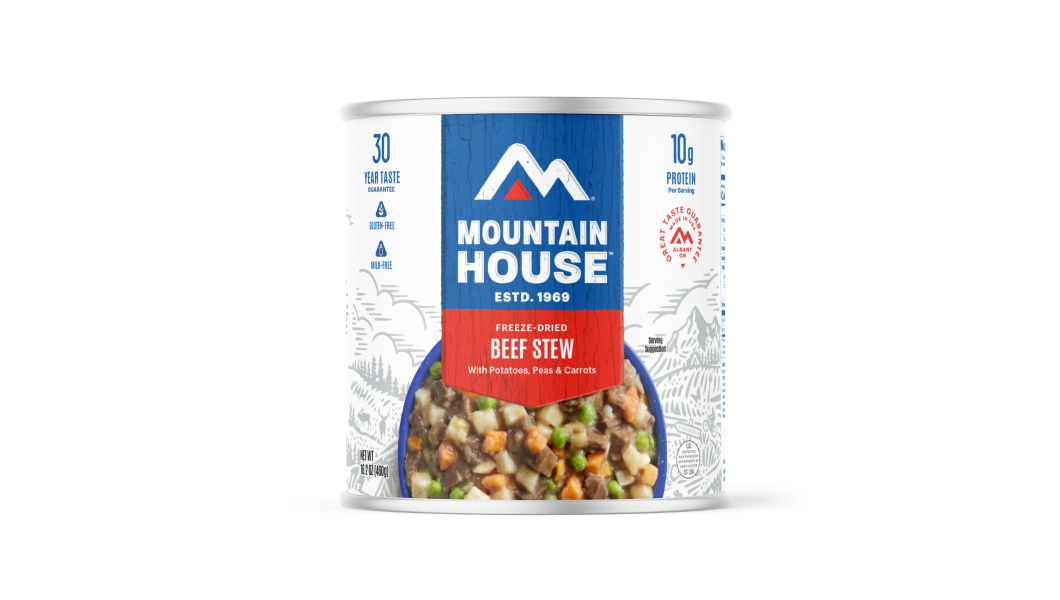


Inspired for an Adventure? Check out Beef Stroganoff - Pouch and Beef Stew - Pouch

State boundaries may be political constructs, but hey, c’mon: That doesn’t detract from the thrill of standing atop the highest ground in each state.
More than a few folks have found themselves pleasantly drawn into “highpointing,” and while that effort can be pursued at any and all geographic scales—from the continental to the county or even municipal—the 50 U.S. states definitely offer an appealing goal.
To inspire your own highpointing ventures, we’ve rounded up all of those state apexes. These are the physical-terrain highpoints, mind you, not the various manmade constructions that, in some of the low-elevation states, can actually exceed the highest ground of the natural landscape.
Why Visit Them All?
Why pursue highpointing at the state (or, heck, any) level? Well, there’s certainly the opportunity to challenge oneself physically and view some gorgeous, often very wild, countryside—but that only pertains to some of these sites. Many state highpoints, in fact, are decidedly not physically taxing to reach and don’t exactly qualify as either wild or particularly showstoppingly scenic.
But even those summits can draw you to special out-of-the-way spots and charmingly nondescript pieces of turf you’d otherwise never find yourself making a pilgrimage to.
And, more often than not, there’s some interesting history woven into these highpoints, whether they’re grand alpine peaks or simply a subtle pastureland swell.
List of Highpoints

Before we dive in, it’s important to note that, as of this writing, all of the U.S. state highpoints are open to the public. But quite a few are found on private land, so it’s essential to (a) confirm the most up-to-date access info and (b) respect all property boundaries and regulations.
With that said, let’s dive in! These are presented in order of elevation, which makes for a continent-sweeping tour from the Last Frontier way up north all the way down to the Sunshine State.
Alaska
Denali (20,310 feet)

The gigantic king peak of the Alaska Range is not just the highest peak in the U.S.: It’s also the crown of North America and the loftiest terrestrial mountain on Earth as measured from base to summit—its 18,000-foot loom in that regard besting Mount Everest—and the planet’s third-most prominent and topographically isolated eminence.
Many visitors to Denali National Park hope for a glimpse of this white giant, often brooding under cloud cover, while world-class climbers test their mettle against its extreme elevation and infamously fierce high-latitude weather.
California
Mount Whitney (14,498 feet)
Spectacular Mount Whitney tops the collection of high peaks in the southern Sierra Nevada sometimes called the Muir Crest. Split between Sequoia National Park and the Inyo National Forest, Whitney tempts hardy hikers up the 22-mile Mount Whitney Trail on its gentler western slope, while its vertiginous, high-relief East Face is a coveted technical climbing adventure.
Colorado
Mount Elbert (14,433 feet)
The Sierra Nevada may rise a bit higher, but the Southern Rockies of Colorado boast by far the most 14ers in the Lower 48. And the Sawatch Range alone claims the top three: 14,420-foot Mount Harvard, 14,421-foot Mount Massive, and then Mount Elbert looming above them all. Elbert’s the loftiest peak in all of the Rocky Mountains, in fact.
Despite its impressive stats, Mount Elbert, situated in the San Isabel National Forest, is a hikeable highpoint, though anyone attempting the trail needs to be prepared for the thin air of the heights (and the threat of summer thunderstorms).
Washington
Mount Rainier (14,411 feet)
The summit of this undisputed goliath of the Cascade Range, meanwhile, is decidedly not a hikeable goal, but rather the sort of formidable alpine challenge mountaineers use to train for Denali and other super-tough summits around the world. Mount Rainier comes clad in more ice than can be found in all the rest of the Cascades combined, and utterly dominates its surroundings like few peaks on Earth.
You don’t need to be a technical climber to appreciate the sheer majesty of Tahoma up-close: Mount Rainier National Park includes multiple stellar viewpoints and trails in the shadow of that glacier-mantled behemoth, not least the classic backpacking circumambulation of the Wonderland Trail.
Wyoming
Gannett Peak (13,810 feet)
Among the most remote and hard-to-reach state highpoints, Gannett Peak rears its blocky mass above the rest of northwestern Wyoming’s unbelievably beautiful Wind River Range, part of the Greater Yellowstone Ecosystem.
Hikers, backpackers, and skilled climbers in the Bridger-Teton and Shoshone national forests can enjoy firsthand this wilderness summit, which also supports the largest glacier—the Gannett—in all of the American Rockies. (The Wind Rivers in general boast the most alpine ice in the Lower 48 outside of Washington State.)
Hawaii
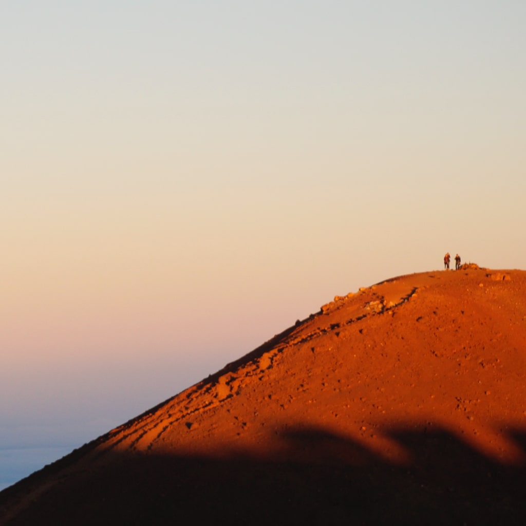
Mauna Kea (13,803 feet)
Mauna Kea’s Hawaiian name means “White Mountain,” a reference to the snows that periodically whiten the top of this huge shield volcano on the northern edge of the tropics. This highest peak on the Big Island is arguably the world’s tallest mountain as measured from its below-sea-level base to its summit, though its near neighbor Mauna Loa outsizes it in mass by an impressive amount.
The Mauna Kea Trail leads hikers (who’ve taken precautions against altitude sickness) to the summit from the telescope complex of the Onizuka Center for International Astronomy at about the 9,300-foot level.
Utah
Kings Peak (13,528 feet)
Named for Clarence King, the first director of the U.S. Geologic Survey, Kings Peak tops the remarkable Uinta Range of the Middle Rockies: a huge block of high-elevation land heavily gouged by Pleistocene glaciers. Hikers can reach the non-technical summit—situated in the sprawling High Uintas Wilderness of the Ashley and Wasatch national forests—but it’s a grueling effort that often exposes trekkers to risky thunderstorms.
New Mexico
Wheeler Peak (13,161 feet)
This handsome peak serves as pinnacle of the mighty Sangre de Cristo Range of the Southern Rocky Mountains, and anchors the Carson National Forest’s Wheeler Peak Wilderness. Hikers beelining for the top of Wheeler Peak have a good chance of spotting bighorn sheep.
Nevada
Boundary Peak (13,140 feet)
Nevada’s highpoint lies a stone’s throw from the California border, up in the imposing heights of the White Mountains: one of the tallest ranges in the Lower 48, with a crest stretching above 10,000 feet for nearly 40 miles. Parched within the rainshadow of the loftier-yet Sierra Nevada to the near west, the Whites offer rich backcountry exploration.
Given Boundary is effectively a subpeak of 13,441-foot Montgomery Peak, many contend Nevada’s “truer” highpoint is the standalone summit of 13,065-foot Wheeler Peak, far east in the Snake Range of Great Basin National Park.
Montana
Glacier Peak (12,807 feet)

Glacier Peak, topping out the big, burly Beartooth Range in the Absaroka-Beartooth Wilderness, is widely regarded as the toughest state highpoint to summit after Denali. Set within shouting distance of Yellowstone National Park, Glacier Peak offers a prized climbing challenge on its north face, which includes the Granite Glacier, while the south side is rarely tackled.
Idaho
Borah Peak (12,665 feet)
Crowning the magnificent Lost River Range, Borah Peak (aka “Mount Borah”) in the Challis National Forest belongs to a skyscraping cluster of peaks spread between Doublespring Pass and Pass Creek Summit. Multiple challenging routes lead up the peak, which supports the only officially recognized glacier in the Gem State.
Arizona
Humphreys Peak (12,637 feet)
Humphreys Peak is the highest of the San Francisco Peaks, which manifest as a compact mountain range but represent the eroded remnants of a single stratovolcano. Part of the Kachina Peaks Wilderness in the Coconino National Forest, this loftiest of Arizona’s mountains is very doable as a hike.
Oregon
Mount Hood (11,239 feet)
Significantly outbulked by Mount Rainier, Mount Hood is just as arresting as a Cascadian snow peak, taking the form of a gnarled, ice-caked horn. Among the most historically active stratovolcanoes in the Cascade Range—and boasting a dozen named glaciers—Portland’s signal peak is one of the world's most frequently climbed alpine summits, but can definitely catch unwary (or cocky) mountaineers out with its demanding conditions and storm-whipped weather.
Climbers and non-climbers alike can appreciate Hood up-close all year-round from historic Timberline Lodge.
Texas
Guadalupe Peak (8,751 feet)
Texas’s highpoint is the glorious crown of the ancient reef composing the Guadalupe Mountains. Situated within the under-appreciated Guadalupe Mountains National Park, the summit can be reached on a challenging 8.4-mile round-trip hike surmounting some 3,000 feet of elevation gain.
South Dakota
Black Elk Peak (7,231 feet)
This spired granite apex of the Black Hills was renamed from Harney Peak in 2016 to recognize the Oglala Lakota holy man who obtained his famous vision at the summit. It’s a reminder of the immense, multicultural, and fraught significance this isolated Great Plains range holds for Plains tribes.
Black Elk Peak rears in the 13,534-acre Black Elk Wilderness of the Black Hills National Forest.
North Carolina
Mount Mitchell (6,684 feet)
Mount Mitchell is not only the elevational culmination of the entire Appalachian chain but also the highest peak in mainland eastern North America. Originally called Black Dome, it’s the highpoint of North Carolina’s Black Mountains, which also include the second-highest peak in the East: 6,647-foot Mount Craig, easily hiked to from the Mount Mitchell summit in Mount Mitchell State Park.
Tennessee
Clingmans Dome (6,643 feet)
The Great Smoky Mountains along the Tennessee-North Carolina line are the second-highest of the many lofty Southern Appalachian ranges after the Black Mountains, and Clingmans Dome is their rooftop. It’s also the highest elevation hit up by the Appalachian Trail.
A paved half-mile trail leads from the Clingmans Dome parking lot to the summit observation tower, which affords a knockout view—especially come leaf-peeping season in fall…
New Hampshire
Mount Washington (6,288 feet)
The notoriously weather-wracked Mount Washington commands the Presidential Range, the magnificent culmination of the White Mountains: highest range in the Northeast. Indeed, Mount Washington’s the only 6,000-footer in the eastern U.S. north of the Southern Appalachians; the nearest ones south are in the Roan Highlands, some 1,500 miles away.
You’ve got multiple means by which to visit this “Arctic island in the temperate zone,” as Mount Washington has been called: driving to the top, hiking or skiing its challenging crest and yawning cirque “ravines,” or taking a ride on the famous Mount Washington Cog Railway.
Virginia
Mount Roger (5,729 feet)
Dayhikers and thru-hikers alike on the Appalachian Trail often take the short spur path up to the top of Mount Rogers, centerpiece of the Jefferson National Forest’s Mount Rogers National Recreation Area. This northernmost island of high Southern Appalachian spruce-fir forest in the Blue Ridge Mountains is also notable for the wild ponies that graze its flanks.
Nebraska
Panorama Point (5,429 feet)

Here’s the first highpoint on our list that’s not a mountain peak, but rather a low-relief heave of high ground. It’s not that Nebraska doesn’t have rugged terrain: The state claims more hills and buttelands than you might guess. But it also has a broad-scale topographic layout gently mounting upwards from east to west, and so it’s the otherwise unassuming loft of windswept Panorama Point on the High Plains—a stone’s throw from the Wyoming and Colorado borders—which takes the top elevational slot in the Cornhusker State. From this prairie height, you can gaze westward to the distant ramparts of the Rockies.
New York
Mount Marcy (5,344 feet)
The Adirondack Mountains of Upstate New York are more allied with the vast, ancient domain of the Canadian Shield than the nearby-ish Appalachians, and encompass one of the more seamless mosaics of settlement and wildland in the country. Multiple trails lead up to the Adirondack crown of Mount Marcy: Tahawas, or “cloud-splitter,” in the Algonquin language, and the literal highpoint of the sublime High Peaks Wilderness.
Maine
Katahdin (5,268 feet)
Mount Katahdin’s figurative stature in the American mythos sees it holding its own with far loftier peaks of the West. This intrusive massif, scalloped Uintas-like by bygone glaciers, marks the suitably grand northern end of the Appalachian Trail, and glowers over the mooseland and outdoor playground of Baxter State Park. You’ve got your pick of summit approaches, none more legendary than the Knife Edge.
Oklahoma
Black Mesa (4,973 feet)
In the far western reaches of the Oklahoma Panhandle, Black Mesa rears up as an enigmatic shortgrass table (and renowned dinosaur bonebed). This major landform, capped by a basalt flow spewed out of southeastern Colorado, reaches greater heights in that state as well as in New Mexico, but the Oklahoma highpoint, protected in the Nature Conservancy’s Black Mesa Nature Preserve, is its own definite draw.
West Virginia
Spruce Knob (4,861 feet)
Spruce Knob marks the highest point of the Spruce Mountain complex, the loftiest reach of the Allegheny Mountains. Trek up to its seductive conifer stands and the lookout of the Spruce Knob Tower in the Spruce Knob-Seneca Rocks National Recreation Area within the Monongahela National Forest.
Georgia
Brasstown Bald (4,784 feet)
Down in the far southern ridge of the mighty Blue Ridge Mountains, Brasstown Bald offers far-reaching views—even out to the skyline of Atlanta, if conditions are nice and clear. Set within the Chattahoochee-Oconee National Forest, the summit includes an observation deck, trails, and the hub of the Brasstown Bald Visitor Center.
Vermont
Mount Mansfield (4,393 feet)
The Green Mountains reach their zenith at the massif of Mount Mansfield, boasting some of the only alpine tundra habitat in Vermont and one of New England’s great outdoor-recreation destinations. The legendary Long Trail traces its ridgecrest, and epic downhill runs await at Stowe Mountain Resort.
Kentucky
Black Mountain (4,145 feet)
A road teasing its way along the Kentucky-Virginia line off Route 160 leads to the summit of Black Mountain, topped by a tower and a plaque. It adds up to a fascinating topping-out amid country drenched in (but not solely defined by) coal-mining history.
Kansas
Mount Sunflower (4,039 feet)
As with Nebraska’s Panorama Point, Kansas’s highpoint is a subdued prairie vantage delivering a special kind of Great Plains panorama (and, like Nebraska’s roof, it’s within shouting distance of Colorado).
“Mount” Sunflower lies on private acreage, but the landowners welcome visitors to the landmark, marked (among other things) by a charming metal sunflower sculpture.
South Carolina
Sassafras Mountain (3,554 feet)
South Carolina’s Blue Ridge highpoint, named for an iconic little hardwood of the eastern forests, sits along the border with North Carolina. You can drive nearly to the tower-topped summit, and get all the way via a short paved path.
North Dakota
White Butte (3,506 feet)

Part of the “Chalky Buttes” along with Rattlesnake Butte, White Butte forms a beautiful crest amid the Little Missouri Badlands on the northern Great Plains. Close to the Little Missouri National Grassland and Theodore Roosevelt National Park, the butte’s on private land, but there’s a trail to the summit open to the public (with a small donation requested).
Massachusetts
Mount Greylock (3,487 feet)
This isolated eminence, or “monadnock,” serves as the highest peak in the Taconic Mountains—an important bastion of New England forestland—and includes the southernmost glacial cirque in the East: the Hopper, which opens up Mount Greylock’s western flanks. That side of the mountain also includes precious stands of old-growth red spruce, designated as a National Natural Landmark in fact.
The Appalachian Trail crosses Mount Greylock, a fine place for hiking, skiing, leaf-peeping, and more.
Maryland
Backbone Mountain (3,360 feet)
Backbone Mountain lies in the Allegheny Mountains on the Maryland-West Virginia border, with an Old Line State-topping summit known as Hoye-Crest. Only reachable by foot, Hoye-Crest—another state highpoint on private land, but open to visitors—can be attained on the Maryland High Point Trail.
Pennsylvania
Mount Davis (3,213 feet)
Mount Davis is another Allegheny summit, sporting a tall observation tower. Among the numerous trails in the Forbes State Forest, a short one takes you from the parking lot to the highpoint of Pennsylvania.
Arkansas
Magazine Mountain (2,753 feet)
Beautifully bluff-girdled Magazine Mountain is the tallest summit in the Ouachita Mountains. Ensconced within the Ozark-St. Francis National Forests, Mount Magazine State Park offers a well-developed recreation site, and not just for highpointing proper: There are plenty of trails, rock-climbing opportunities—even hang-gliding!
Alabama
Cheaha Mountain (2,405 feet)
Part of the Blue Ridge subrange called the Talladega Mountains, Cheaha Mountain lies within an eponymous state park that’s surrounded by the Talladega National Forest and borders the 7,245-acre Cheaha Wilderness. The Civilian Conservation Corps built the mountaintop tower, called Bunker Tower.
Connecticut
Mount Frissell SW Slope (2,382 feet)
Technically speaking, Mount Frissell’s southwestern flank marks Connecticut’s highest point; the Taconic peak rises another 70-odd feet to its summit in Massachusetts. A hiking trail leads to the slopeside outcrop marking the Constitution State’s highpoint on the state boundary line.
Now, mind you, more than a few highpointers would also—or even alternatively—trek their way to the top of 2,316-foot Bear Mountain, also in the Taconics and crossed by the Appalachian Trail, as that’s the highest true summit falling fully within Connecticut.
Minnesota
Eagle Mountain (2,301 feet)
It’s somehow appropriate that the old granite of Minnesota’s highest hill should rise amid one of its superlative landscapes: the Boundary Waters Canoe Area Wilderness of the Superior National Forest, most famous as a paddling destination but also offering plenty of on-foot exploration.
The 3.5-mile Eagle Mountain Trail climbs to this loftiest summit in the Misquah Hills, which overlooks Whale Lake. (Don’t forget your self-issued Boundary Waters Canoe Area Wilderness Permit at the trailhead…)
Michigan
Mount Arvon (1,979 feet)
The remote Huron Mountains of Michigan’s Upper Peninsula constitute some of the highest and most rugged country in the Midwest. Their crowning peak is Mount Arvon, rising a mere eight miles from Lake Superior and offering views out to that mightiest and most oceanic of the Great Lakes.
Remarkably, just one foot distinguishes Mount Arvon as the Wolverine State’s highpoint over nearby Mount Curwood, which until the early 1980s was thought to be number one.
Wisconsin
Timms Hill (1,951 feet)
While the highpoints of Minnesota and Michigan are bedrock knobs, Wisconsin’s is a great mound of heaped-up glacial and lake sediment, deposited between two major lobes of the Laurentide Ice Sheet that's responsible for so much of the lay of Dairyland’s land. That said, the roughest terrain in Wisconsin prevails where the Pleistocene ice didn’t reach: the bluff-and-coulee expanse of the Driftless Area in the state’s southwest. But it’s up in the generally more subdued-looking Northern Highlands where the highest ground lies.
You can reach the top of Timms Hill, which supports a lookout tower, in Timms Hill County Park. The Timms Hill Trail, meanwhile, links this champion promontory to the long-distance Ice Age Trail.
New Jersey
High Point (1,803 feet)

The long Appalachian ridge of Kittatinny Mountain rises to the (ahem) creatively named highpoint of New Jersey, which you can drive up to. The vantage of High Point provides sightlines out into New York and Pennsylvania and comes marked by a 1930-built obelisk serving as a war monument.
Missouri
Taum Sauk Mountain (1,772 feet)
Missouri’s highpoint lies atop the St. Francois Mountains, a hub of downright ancient Precambrian rocks within the broader belt of the Ozark Plateaus. Taum Sauk State Park encompasses the peak and helps compose quite the recreational wonderland with adjoining Johnson’s Shut-ins State Park and the Bell Mountain Wilderness Area.
You can “bag” the highpoint via the paved path leading to the top, or embark on a longer adventure by hiking the full Taum Sauk section of the Ozark Trail.
Iowa
Hawkeye Point (1,670 feet)
Hawkeye Point is a gentle farmland rise on the Northwest Iowa Plains, which geologist Jean Cutler Prior described in a guide to Iowa’s landscapes as “a ‘jumping-off place,’ a definite step upward to the High Plains of the Dakotas.” Now owned by Osceola County, Hawkeye Point comes well-marked, not least by a long-standing collection of state license plates.
Just a hop, skip, and a jump east, on the glacial uplands of the Des Moines Lobe, the more topographically prominent Ocheyedan Mound (1,655 feet) was long thought to be Iowa’s highpoint. If you’re seeking out Hawkeye Point, you might as well also take a gander at that more defined hilltop.
Ohio
Campbell Hill (1,549 feet)
Ohio’s highpoint lies on a glacial moraine in Logan County. The flagpole- and monument-marked hilltop, located on the campus of a technical school, is open to the public during the week.
Indiana
Hoosier Hill (1,257 feet)
A bedrock rise overlain by thick sediment deposits at the far south end of the Tipton Till Plain forms Hoosier Hill, Indiana’s loftiest piece of ground. It’s located on private land, but you can visit the summit, which includes a bench, picnic table, and a sign.
Illinois
Charles Mound (1,235 feet)
A mere quarter-mile from the Wisconsin border in the Illinois portion of the Driftless Area, Charles Mound is also on private acreage, but the landowner allows visitors (dedicated highpointers included) on certain summer weekends.
Named after an early Euro-American settler who lived at its base, Charles Mound stands near the village of Scales Mound, which markets itself as “At the Top of Illinois.”
Rhode Island
Jerimoth Hill (812 feet)
Hey, we’re under 1,000 feet here! Set on Brown University land and used as a stargazing site by astronomy classes, Jerimoth Hill was, for a long time, notoriously tricky to access on account of intervening private land. As of today, though, it’s a straightforward, no-hassle stroll to the summit outcrop.
Mississippi
Woodall Mountain (806 feet)
A steep road leads you up to the radio-tower-spiked summit of Mississippi’s highpoint. Located in the rolling Tombigbee Hills of Tishomingo County in the state’s far northeast, Woodall Mountain includes a bench and a summit register.
Louisiana
Driskill Mountain (535 feet)
Part of the Tertiary Uplands of north-central Louisiana, in Bienville Parish near Bryceland, Driskill Mountain is another of the state highpoints on private acreage but open to public access. Two trails lead to its summit, marked by a forest-edged clearing.
Delaware
Ebright Azimuth (447.85 feet)
As it happens, Ebright Azimuth, the marked highpoint of Delaware, isn’t quite the true highpoint: The Delaware Geological Survey notes that a couple of spots close by, to the west of Ebright Road, actually rise to 450 feet. But, hey, visiting the signed Ebright Azimuth is good enough.
Florida
Britton Hill (345 feet)

The lowest state highpoint by a fair measure, Britton Hill rises within the rolling ground of the Florida Panhandle’s Western Highlands. Its measly elevation isn’t really a surprise, given the geologic setting of the Sunshine State, which can lay claim to some of the most glorious lowlands in the country. And farther south down the Florida peninsula, differences in only a few feet play a major role in the layout of ecosystems thanks to the impact on hydroperiod (how long a site lies underwater).
But back to Britton Hill: You can visit it in pleasant Lakewood Park, which includes the marked highpoint as well as walking trails.
Mountain House: Powering Your Hightpointing Adventures
From the technical pitches and scrambles of the West’s icy horns to those modest humps and bumps topping our lower, flatter, but still gosh-darn beautiful states, choose Mountain House just-add-hot-water meals to keep your highpointing self properly fueled up!
Whether you’re road-tripping or backpacking to reach these hallowed heights, explore our selection of freeze-dried deliciousness.


Backpacking Meal Upgrades: Add-Ins That Travel Light
The best upgrade you can make to a freeze-dried backpacking meal isn't a new recipe- it's knowing which add-ins earn their pack weight. On the trail, every ounce matters, so it ...
Read more


Best Freeze-Dried Meals for Summer Backpacking Trips
The best freeze-dried meals for summer backpacking are lightweight, calorie-dense, water-efficient, and heat-stable. Summer adds specific demands that a shoulder-season kit may ...
Read more


