Inspired for an Adventure? Check out Beef Stroganoff - Pouch and Beef Stew - Pouch
Free Ground Shipping On All Orders
Over 2,100 Reviews
Add description, images, menus and links to your mega menu
A column with no settings can be used as a spacer
Link to your collections, sales and even external links
Add up to five columns
Add description, images, menus and links to your mega menu
A column with no settings can be used as a spacer
Link to your collections, sales and even external links
Add up to five columns
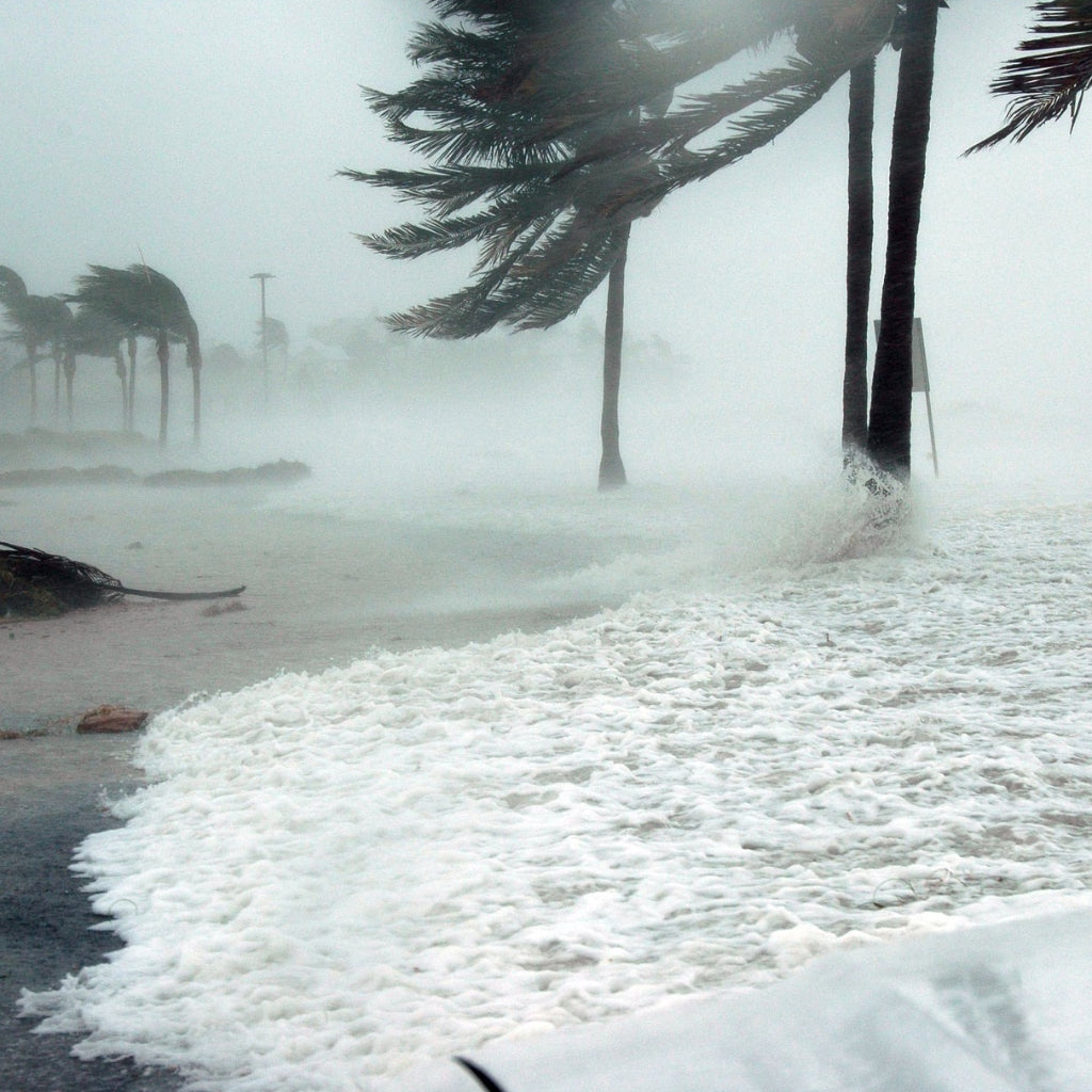

Natural disasters are an everyday reality of life on Planet Earth. Whether a multiyear drought or the more sudden blast of a volcano or spin-up of a tornado, these events have threatened human safety and survival since Day One.
While climate change has made many natural disasters more frequent, we also have greater knowledge, more robust warning systems, and more varied resiliency measures in place than ever before. Education is the first step to protecting yourself from these often awe-inspiring natural phenomena.
To that end, we’ve pulled together a basic introduction to a dozen of the most notable natural disasters, both in the U.S. and around the world.
Earthquakes

The geologic shudders called earthquakes rank among the most devastating natural disasters on Earth—and a reminder of how restless our planet is. Their tremors are generally triggered by crustal movement along faults and tectonic-plate boundaries, and the abrupt release of energy generates seismic waves that ripple away from the epicenter. The most familiar measure of an earthquake’s strength is the Richter scale, which represents how much energy is released in a temblor. It ranges from 0 to more than 9.0; each step up in magnitude is associated with an increase in energy of roughly 32 times.
The most powerful quakes are so-called megathrust earthquakes, associated with the subduction zones where one tectonic plate dives beneath another at a convergent plate boundary. Megathrust quakes account for all the recorded earthquakes of 9.0 or greater magnitude.
But the all-out strongest earthquakes aren’t always the deadliest or costliest: Lower-magnitude quakes that strike densely populated areas, or where buildings lack adequate seismic reinforcement, can result in many casualties and extensive damage. While injuries and deaths may occur directly from earthquake damage, as from collapsing buildings or falling debris, significant damage and loss of life can also result from secondary effects (some of which, such as landslides and tsunamis, we’ll cover elsewhere in this article).
Earthquakes have occurred widely across the U.S., but are most significant in the tectonically active West—especially the West Coast—and Alaska and also in parts of the Mississippi River Valley.
Largest & Deadliest Earthquakes
The three largest earthquakes since 1900 are the magnitude-9.5 Valdivia Earthquake, which rattled Chile in 1960; the magnitude-9.2 Great Alaska or Good Friday Earthquake, which affected southern Alaska in 1964; and the magnitude-9.1 Indian Ocean Earthquake, which struck off the coast of northern Sumatra in 2004 and produced a devastating tsunami.
That 2004 Indian Ocean Earthquake is the deadliest of the 21st century so far, primarily on account of its resulting tsunami. The three deadliest known earthquakes in history occurred in China: the Jiajing Great Earthquake of 1556, the Great Tangshan Earthquake of 1976, and the Haiyuan Earthquake of 1920.
Earthquake Preparedness
Earthquakes strike unequally across Earth’s surface, and while they remain frustratingly hard to predict, you can certainly take steps to prepare your home based on the relative earthquake hazard of your region.
Such steps range from securing heavy objects such as bookcases and pursuing retrofitting (such as attaching your house to its foundation) to acquiring an earthquake insurance policy. Learn more—including what to do during an earthquake—at Ready.gov and about the Great ShakeOut drill.
Landslides & Debris Flows
A lot of movement on the surface of our planet goes down at an imperceptibly slow pace: as in the sluggish but relentless soil creep underway on just about any sloping ground. But sometimes masses of rock and soil move suddenly and rapidly as a landslide or (mixed with lubricating water) debris flow.
The causes of landslides are many and varied: undercutting streams causing riverbanks to fail, the shaking of earthquakes, volcanic eruptions (which can produce the violent flowing slurries known as lahars, also addressed later in the “Volcanic Eruptions” section), heavy rains or rapid snowmelt activating slopes (including those destabilized by recent wildfires), unstable valley walls left by a retreating glacier giving way—and, of course, just the relentless tug of gravity finally winning out over a steep-set hillside.
Landslides and debris flows can happen at any scale—from a slumping embankment to a whole mountainside slipping away—and may happen just about anywhere there’s even slightly sloping terrain.
The Danger of Landslides
Landslides may move at frighteningly rapid speed, 100 miles per hour or more. They can destroy homes, bury vehicles, block roadways, and dam rivers.
As the U.S. Geological Survey notes, perhaps 25 to 50 deaths a year in the U.S.—and thousands worldwide—result from landslides, which also annually cause billions of dollars worth of damage around the globe.
Some Notable Examples
The deadliest standalone landslide in U.S. history occurred on March 22, 2014: the Oso Landslide (or SR530 Landslide). Heavy winter rainfall likely contributed to the failure of a hillside above the North Fork Stillaguamish River outside Oso, Washington. The resulting mudslide and debris flow of some 18 million tons of sediment moved at more than 40 miles per hour down upon the neighborhood of Steelhead Haven. Forty-three lives were lost and several dozen structures destroyed.
Most of the deadliest and costliest landslides have been associated with earthquakes and volcanic eruptions. In May 1970, for example, the Ancash Earthquake in the Peruvian Andes triggered a mudflow off the slopes of 22,205-foot Nevado Huascarán that buried the city of Yungay, with casualties in the tens of thousands. In 1949, close to 30,000 people died as a result of the quake-sparked Khait Landslide in Tajikistan.
Landslide Safety
Landslides can occur suddenly and with little advance warning. It’s important to assess your home’s vulnerability based on slope, soil type, and geologic unit. Particular events should alert you to an increased probability of landslides, such as torrential downpours, wildfires, earthquakes, and volcanic eruptions. Also, keep an eye out for signs of creeping or slumping ground—from cracks in a foundation or heaved-up soil—which could set the stage for a more catastrophic failure. Learn more at Ready.gov.
Hurricanes & Tropical Storms
Arguably the most awesome storms on our planet, tropical cyclones—also called hurricanes or typhoons—are birthed over tropical oceans, usually in the belt between about 10 and 30 degrees latitude.
Warm seawater is their ultimate fuel. Evaporation off the ocean surface under strong solar heating primes the atmosphere with moisture. A slight low-pressure disturbance causes this moist air to rise and cool, producing condensation of clouds, which in turn releases energy in the form of latent heat. That heating intensifies uplift, enhancing the low-pressure center and sucking in wind that, warped by Earth’s rotation, begins swirling in cyclonic fashion around until a storm is formed.
That’s a super-simplified explanation of how a tropical disturbance evolves into a tropical storm and then (once winds hit at least 74 miles per hour) a full-blown hurricane, defined by an eyewall of towering thunderheads flanked by spiraling rainbands. Winds in these huge storms, which may span more than 1,000 miles across, can in extreme cases approach or even exceed 200 miles per hour. More than 80 tropical cyclones form on average each year.
Hurricanes are generally driven westward by the trade winds, with the majority eventually veering—aka recurving—poleward. Regular hurricane tracks exist in the Northwest Atlantic, Northeast Pacific, Northwest Pacific, Southwest Pacific, and Indian oceans. Hurricanes typically sputter out when they recurve into colder, higher-latitude waters or travel inland over continents, in both cases losing their fuel supply of warm seawater.
Hurricane Scale
Hurricanes are classified by their intensity through several different windspeed-based scales. The U.S. uses the Saffir-Simpson Hurricane Wind Scale, which ranges from Category 1 storms (74 to 95 mph winds) to Category 5 storms (157-plus mph winds).
Hurricane Season
Because of their dependence on ocean waters around 80 degrees Fahrenheit or warmer, hurricanes tend to form seasonally in many parts of the world, although in the Northwest Pacific—where they’re referred to as typhoons—they can develop just about any time of year.
In the continental U.S., which is most regularly affected by North Atlantic tropical cyclones, hurricane season generally runs from June through November.
Hurricane Effects on Coastal Regions
Enormous damage can result when hurricanes pass over islands or make landfall on continental margins. Those ferociously high winds are definitely a major impact, though statistically the deadliest effects of hurricanes come from flooding: Landfalling hurricanes drive seawater inland via storm surges, and can also produce floods through their own torrential rainfall. Lightning and even tornadoes, which sometimes form along the margins of hurricanes, are also associated risks.
Some Notable Hurricanes
The highest sustained hurricane wind speed was recorded in Hurricane Patricia (2015) in the Northeast Pacific, which reached 215 miles per hour. The highest windspeed documented for a North Atlantic hurricane was 190 miles per hour, during Hurricane Allen (1980).
Typhoon Tip (1979) in the Northeast Pacific was both the biggest—at some 1,380 miles in diameter—and most intense (hitting a low pressure of 870 hPa) tropical cyclone yet recorded. (Hurricane Wilma in 2005 logged the lowest pressure of any North Atlantic hurricane: 882 hPa.)
The costliest tropical cyclones were two North Atlantic hurricanes: Hurricane Katrina (2005) and Hurricane Harvey (2017), which both resulted in an estimated $125 billion worth of damage.
The deadliest known tropical cyclone was the 1970 Bhola Cyclone, which formed in the Bay of Bengal; it resulted in perhaps as many as 500,000 deaths in India and Bangladesh (then called East Pakistan). The deadliest hurricane in the Western Hemisphere is thought to have been the Great Hurricane of 1780, which killed about 22,000 in the West Indies.
The deadliest hurricane to strike the U.S. was the Galveston Hurricane of 1900, which may have killed more than 8,000 people—many dying in the devastating storm surge that overswept Galveston Island.
Hurricane Preparation & Safety
From long-term structural enhancements of a home in a hurricane zone to heeding evacuation orders in advance of a landfalling storm, there’s much you can do to protect yourself from tropical cyclones. Check out our “Ultimate Hurricane Survival Kit Checklist,” as well as the Ready.gov resources, for more information.
Floods

Floods, wherein water inundates land that’s normally dry, are the most frequent and widespread of all natural disasters. They can happen anywhere, and result from a dizzying variety of causes. Those include heavy sustained rainfall, seasonal overspilling of rivers and other waterbodies, blocked watercourses, rapid snowmelt, hurricane storm surges, breached levees, and dam failures—not to mention human error in myriad manifestations.
Threats from flooding range from drowning, waterborne illness, contamination, and electrocution to loss of property and expensive repair or rehoming costs. Hydrologists distinguish between slow-onset floods, which may be drawn out over weeks or even months, and fast-onset floods, which may occur on the order of minutes. Among the most dangerous are flash floods, which as the name suggests are extremely rapid inundations, often prompted by cloudbursts and other torrential downpours.
In the U.S., floods claim more lives each year on average than tornadoes, hurricanes, or lightning strikes, and rank as the most common and costliest natural disaster. Climate change is likely to enhance flood risk in many parts of the world due to more intense rainstorms and rising sea levels.
Notable Examples
Major floods in China have killed hundreds of thousands of people; the Yangtze-Huai River Floods of 1931, which may have resulted in more than a million deaths, ranks among the deadliest natural disasters in history.
Some of the most impactful floods in U.S. history have been associated with hurricanes or dam failures. The deadliest include the storm surge of the Galveston Hurricane of 1900, the floodwaters unleashed in South Florida by the 1928 Okeechobee Hurricane, and the 1889 Johnstown Flood, in which roughly 2,200 people lost their lives due to the failure of the South Fork Dam upriver of Johnstown, Pennsylvania.
More than 200 were killed during the Heppner Flood of 1903 in eastern Oregon, triggered by heavy thunderstorm rains and regarded as the second-deadliest flash flood in U.S. history after the Johnstown Flood.
Among the costliest U.S. floods in modern times was the Great Flood of 1993, which inundated some 30,000 square miles in the Mississippi and Missouri drainages in the Midwest—including 15 million or more acres of farmland—due to extreme spring and summer rainfall and saturated soils. It affected close to 150 rivers and streams within those basins and resulted in about $15 billion worth of damage.
Preventing Flood Damage
Almost anyplace can be affected by a flood, but certainly some areas are much more prone to flooding than others. In the U.S. and around the world, many people live in such flood-prone areas, from coastal plains and lakeshores to stream valleys.
Check out FEMA’s Flood Map Service Center to assess your risk, bone up on flood safety, and visit Ready.gov for more info.
Cold Snaps or Waves
Abrupt plunges in temperature, or simply extended periods of cold, can definitely qualify as natural disasters. The National Weather Service defines a cold wave as “a rapid fall in temperature within 24 hours to temperatures requiring substantially increased protection to agriculture, industry, commerce, and social activities.”
Unexpected or unseasonable plunges in temperature, or prolonged cold snaps, can be dangerous in many ways: not only exposing people to frostbite, hypothermia, and other potentially life-threatening cold-weather conditions as well as carbon monoxide poisoning but also crippling infrastructure, bursting water pipes, making transportation hazardous. Early or late cold waves can also harm crops, hammering agricultural operations.
A Few Notable North American Cold Snaps
Prone as it is to deep invasions of Arctic air in the wintertime, North America commonly experiences widespread cold snaps. Some recent examples include the cold waves of February 2021 and January to February 2019, which brought the most frigid temperatures in decades to many U.S. cities.
During the cold snap of January 1977, snow actually fell in Miami and in the Bahamas. Exceptional cold across much of the continent defined February 1936, while the Great Arctic Outbreak of February 1899 saw all of the 45 U.S. states that existed then fall below freezing and set a slew of low-temperature records, some of which still stand.
Cold Weather Safety
Get useful tips on protecting yourself during especially cold weather via the National Weather Service and Ready.gov sites and learn how to endure a wintertime power outage.
Blizzards & Winter Storms
“Blizzard” is bandied about pretty loosely in a colloquial sense, but has a fairly strict meteorological definition. In the U.S., the National Weather Service defines blizzard conditions as winds of 35 or more miles per hour coalescing with falling or blowing snow and reduced visibilities of a quarter-mile or less, sustained for a minimum of three hours. But the broader terms snowstorm (of which a blizzard would be an example) or winter storm can be pretty sturdily applied to any period of heavy frozen precipitation or windblown snow.
Extratropical cyclones (such as the infamous nor’easters of the Atlantic coast) and frontal systems in winter often create snowstorms or blizzards due to convective precipitation and blustery winds as a front passes over. Areas along the leeward shores of the Great Lakes in the U.S. and Canada are commonly pummeled by lake-effect snowstorms as cold airmasses sweep over comparatively warm lakewaters and pick up moisture.
But nothing more than a sharp pressure gradient combined with loose snow on the ground can produce a blizzard, given the strong winds that result. (Blowing and drifting snow that reduces visibility is often called a ground blizzard to distinguish it from a weather event inducing falling snow as precipitation combined with winds.)
From traffic accidents to life-threatening windchills, blizzards, and severe snowstorms can be serious business indeed—and they not uncommonly overlap with or precede cold snaps, combining crippling snowfall or drifts with frigid conditions.
Notable North American Blizzards & Snowstorms
The U.S. and Canada are no strangers to big-time blizzards and crippling winter storms, needless to say. Among the areas regularly afflicted include the Northern Great Plains, the Upper Midwest, and the Atlantic coast of the northeastern U.S. and adjacent Canada. Brutal snowfalls can also extend well south in the eastern U.S., though, and also, unsurprisingly, rage in the high country of the West’s mountain systems.
There are definitely too many notable historic North American snowstorms to do justice to here, but it’s worth mentioning a few, not least the Hard Winter of 1880-1881 (immortalized in Laura Ingalls Wilder’s The Long Winter “Little House” book). Then there was the Great Blizzard of 1978, which brought large portions of the Ohio Valley and Great Lakes regions to a standstill; the epic Storm of the Century in March 1993, dominating much of eastern North America; the 2011 Groundhog Day Blizzard; and the January 2016 U.S. blizzard.
Most common in winter, big snowstorms sometimes hit during the shoulder seasons of fall and spring—as in the early blizzard that howled across the Northern Plains with 40- to 50-mph winds and heavy snows in mid-November 2022.
Snowstorm Preparedness & Safety
Fortunately, major blizzards and snowstorms these days tend to be pretty well forecast, usually giving you plenty of lead time to prepare. Learn about weathering such as wintry maelstroms over at the National Weather Service site.
Drought
As the U.S. National Integrated Drought Information System has noted, drought’s a bit different from a natural disaster such as a tornado or a flood, defined by the presence of some powerful force, in that, it’s defined by the absence of something: namely, moisture. There are various overlapping technical definitions of drought, but generally speaking, it can be thought of as a prolonged period of abnormally dry conditions with adverse impacts on moisture levels and water supply.
Many parts of the world experience climates with pronounced dry seasons that, if extended or especially severe, can easily roll into some form of drought. Even climates with relatively consistent year-round precipitation, as defines much of the eastern U.S., are vulnerable to summer drought, if particular weather patterns—such as a stubborn high-pressure system or a moisture-blocking setup—see a rainless stretch during this hottest time of year.
Experts classify different categories of drought based on their observed effects, including meteorological drought (prolonged period of dry weather—generally the base-level prerequisite for the other kinds), hydrological drought (when moisture stress and/or reduced water availability become evident), and agricultural drought (when impacts to crops start manifesting).
Drought can have enormous and wide-ranging impacts, from human health to food supply, water quality, and ecological services. It can also make other natural disasters, namely wildfires, more likely.
Dealing With Drought
There are many steps you can take to both protect yourself and conserve water during a drought. Learn more via the National Weather Service, Drought.gov, and Ready.gov. You can check the current drought status for the U.S. and monitor them online.
Heatwaves

All too often going hand in hand with drought during the summer, heatwaves rank among the deadliest of all natural disasters, even if they’re not quite as immediately dramatic as a raging hurricane or wildfire.
A heatwave is usually defined as unusually high temperatures enduring past two days. The U.S. Department of Homeland Security defines extreme heat as temperatures above 90 degrees combined with high humidity lasting at least two or three days. Greater humidity can make hot weather feel even hotter, though you can certainly have a heat wave with low humidity.
As with drought, a heatwave is a relative phenomenon: Temperatures within the normal range for a hotter climate may be highly abnormal, with deleterious effects, for a cooler one.
Stubborn high pressure and shifts in the jet stream are among the atmospheric processes that can set a regional heat wave in motion. While a heatwave or two each year is normal during the summer in many places, they appear to be increasing in both frequency and severity, and experts project this trend to continue as the average global temperature continues to ramp up under climate change.
Recent years have seen devastating heat waves in areas not accustomed to prolonged high temperatures, such as the Pacific Northwest in North America and the British Isles. In such places, where fewer people may have air-conditioning and infrastructure hasn’t been designed with extreme heat in mind, a long stretch of extremely hot weather can be especially impactful.
Heatwave Impacts
Extreme heat can induce a variety of dangerous, even life-threatening illnesses, including heat exhaustion and heat stroke. It can enhance the effects of drought, reduce food and water supplies, disrupt transportation and power transmission, and elevate wildfire risk.
Preparing For & Enduring Heatwaves
Protecting yourself, your pets, and your neighbors is paramount during a heatwave. Learn more about the effects of extreme heat and how to respond with resources from the National Weather Service and Ready.gov.
Wildfires
Wildfires are another natural disaster that appear to be increasing under climate change: more acres burned more intensely, and wildfire seasons extending (in some places, as in parts of California, to essentially a year-round reality).
Fire is a fundamental force on our planet, which happens to be highly flammable given its vegetation, its abundant oxygen, and prolific lightning. But while thunderstorms (and also volcanic activity) have sparked blazes for countless eons, humans have also been an important ignition source for wildfires going back millennia.
While historically much of that anthropogenic burning has been a valuable and instrumental tool in sculpting landscapes and ecosystems, these days a lot of “bad fires” result from careless or unintentional human action. In the U.S., people cause close to nine out of 10 wildfires.
Many terrestrial ecosystems have evolved under the influence of fire, adapted to burn occasionally or frequently, mildly or intensely. But hotter weather and more frequent droughts, combined with the ever-expanding footprint of humankind, make for a new normal when it comes to the presence and behavior of wildfires in many parts of the world.
Even a wildfire behaving under historically typical patterns in a particular landscape, and therefore likely doing plenty of ecological good, can nonetheless threaten human life and livelihood—an increasingly common occurrence as the so-called wildland-urban interface balloons.
Notable Wildfires
Wildfires can be defined in terms of size, intensity, cost, loss of life, and/or in terms of their influence on shaping public perceptions and official policies regarding such burns. Iconic historic blazes range from the 1910 Big Blowup in the U.S. Northern Rockies, which reshaped how the Forest Service and other land-management agencies responded to wildland fires, to the Black Friday Bushfires that swept across nearly five million acres in Victoria, Australia in 1939.
The 1987 Black Dragon Fire, which scorched some 18 million acres of conifer forest in northeastern China and the Russian Far East, revealed a striking contrast between China’s aggressive firefighting response and the then-Soviet Union’s let-it-burn policy. The 1988 Yellowstone fires marked another shift in how the U.S. government approaches wildfire management—and demonstrated the complexity of handling wildfires that burn across the jurisdictions of land-management agencies (in this case, the National Park Service and the Forest Service).
In the U.S., the deadliest recorded fire remains the Peshtigo Fire, which burned more than a million acres in northeastern Wisconsin in 1871 and killed more than 1,200 people.
Recent decades have seen too many notable wildfires to count: from the Black Saturday Fires of Victoria, Australia in 2009 and the extensive fires Greece experienced in 2007 and 2021 to the gigantic taiga wildfires that have raged in Siberia each of the past several years. As of June 2023, Canada was already experiencing its worst fire season in recorded history, with more than 400 wildfires burning across the country in multiple provinces.
Wildfire Prevention & Safety
From backwoods cabins to major towns and cities, as many as one in six Americans live in areas of significant wildfire risk. There are many measures you can take to protect your home and property, including maintaining adequate defensible space. And it’s imperative to pay attention to current wildfire risk levels and follow updated regulations and common-sense practices to avoid accidentally starting a blaze.
You can learn more about wildfire risk and mitigation via the National Interagency Fire Center, the Bureau of Land Management, and Ready.gov. In addition, the Mountain House blog has published quite a few articles on the subject, including: “How to Prepare for Wildfires” and “Wildfire Safety: Defensible Space.”
Tornadoes
Hurricanes may be far larger, but no storm on Earth is as violent as a tornado (aka “twister”). These epic whirlwinds, which descend out of strong thunderstorms (and especially those rotating thunderstorms known as supercells), may spin at more than 300 miles per hour. The strongest twisters, which literally scour the ground, can completely destroy entire towns.
Tornadoes form in many parts of the world—they’re known from every continent except Antarctica—but the U.S. is without question the global leader in tornado frequency (an average of 1,200 each year) and strength: a dubious distinction that stems from a favorable geography allowing for frequent clashing air masses and ample incursions of thunderstorm-forming moisture.
The Enhanced Fujita Scale (EF-Scale) is used to rate tornado intensity, with the weakest category being EF-0 and the strongest—including twisters with winds greater than 200 miles per hour and wielding “incredible damage”—EF-5.
Tornadoes tend to be fairly short-lived, usually lasting about 15 minutes or less and tracking along the ground for a few miles. Some, however, may journey more than 100 miles. In the U.S., they’re most likely to form in spring but may occur anytime of year.
Some Notable Tornadoes
The highest known tornadic wind speeds were recorded in the 1999 Bridge Creek-Moore Tornado that hit Oklahoma City and the 2013 El Reno Tornado, both of which were recorded north of 300 miles per hour. The El Reno Tornado was also the widest tornado ever recorded, some 2.6 miles across.
The largest documented tornado outbreak was the 2011 Super Outbreak, which saw tornadoes break out across a huge swath of the eastern U.S. from the Deep South to the Northeast, including four EF-5 tornadoes. More than 300 deaths resulted.
On March 18, 1925, the deadliest tornado outbreak in U.S. history, killing 751 deaths and injuring nearly 2,300, took place in the central part of the country. The single deadliest of the outbreak was the infamous Tri-State Tornado, which also holds the record for the longest-known track of a single twister: more than 200 miles long.
The Ganges Basin is also prone to tornadoes, and due to its very high human population density, Bangladesh experiences the greatest annual tornado-related mortality in the world. The single deadliest tornado in recorded history occurred there: the 1989 Daulatpur-Saturia Tornado, thought to have killed approximately 1,300 people.
Tornado Safety
While atmospheric scientists and meteorologists have hugely expanded our knowledge of tornado formation and behavior in recent decades, twisters remain somewhat mysterious, and predicting their occurrence remains a challenge. Take heed of all severe thunderstorm and tornado watches and warnings issued by the National Weather Service, and identify the safest place to shelter in your home: from certified storm shelters or safe rooms to basements or interior windowless rooms.
Learn more about tornado safety from the National Weather Service and Ready.gov.
Tsunamis
Sometimes inaccurately called “tidal waves,” tsunamis are huge wave series triggered by undersea earthquakes, volcanic eruptions, calving glaciers, flipping icebergs, landslides, and other major displacements of large volumes of water. Forming big swells at sea (or in large lakes), tsunamis turn into towering, terrifying breakers when they strike coastlines, surging well inland.
Because tsunamis are prompted by abrupt, often unpredictable events—from a sudden submarine tremor to a capsizing iceberg—people in coastal areas often have only a brief heads-up that one may be headed their way. That’s especially true for coastlines near a trigger source, such as an offshore subduction zone; an earthquake there could generate a massive tsunami on the adjacent coast within minutes. One striking sign of some imminent tsunamis is a great recession of nearshore waters, a drawback exposing normally submerged seafloor before the giant waves hit the shore.
The aforementioned 2004 Indian Ocean Earthquake generated a huge tsunami with a height of up to 100 feet that killed nearly 230,000 people along coastlines in that ocean basin. This was the deadliest known tsunami.
Tsunami Safety
Understanding your overall tsunami risk and how tsunami warning systems work as well as knowing local evacuation routes can help keep you safe in the event one of these violent waves strikes. Learn more at the American Red Cross and Ready.gov.
Volcanic Eruptions

It’s hard to think of a more stop-you-in-your-tracks dramatic natural disaster than an erupting volcano. Like earthquakes (with which they’re often associated), volcanic eruptions are a reminder of the primal tempestuousness of our planet.
Volcanic activity takes many forms, from the “classic” violent, explosive eruptions of a stratovolcano to the gentler (but still potentially catastrophic) oozing of basaltic lava out of shield volcanoes and such smaller-scale phenomena as steam explosions and the opening of fumaroles. And we’ve already mentioned the volcanic mudflows known as lahars, which don’t need an actual eruption to unleash.
Volcanic eruptions pose a multitude of hazards, including lahars, pyroclastic flows (fast-moving clouds of hot gas and volcanic debris), lava flows, ashfall, floods, and tsunamis. They can also cause an array of other issues in their aftermath, placing people at risk due to reduced transportation and services, disease outbreaks, and food and water supply issues. Massive volcanic eruptions can even affect global climate by adding large amounts of ash and gasses to the atmosphere.
Some 161 active volcanoes are identified in the U.S., with the bulk in Alaska, the Pacific Northwest, and Hawaii. The International Association of Volcanology & Chemistry of the Earth’s Interior (IAVCEI) categorizes 16 Decade Volcanoes that are considered particularly dangerous because of their eruptive history and proximity to population centers. Two of these are in the U.S.: Mount Rainier in the Cascade Range of Washington and Mauna Loa on the Big Island of Hawaii.
Other Decade Volcanoes include Mount Etna and Vesuvius in Italy, Russia’s Avachinsky and Koryaksky on the Kamchatka Peninsula, Mount Nyiragongo in the Democratic Republic of the Congo’s Virunga Mountains, and Galeras in the Colombian Andes.
Notable Volcanic Eruptions
There are too many notable volcanic eruptions to list here, but it’s worth mentioning such especially deadly examples as the massive 1815 Tambora Eruption (which, between direct volcanic mortality and subsequent starvation and disease, may have killed more than 90,000 people) and the 1885 Krakatau Eruption (which killed tens of thousands, many perishing in tsunamis).
Some of the largest eruptions have, thankfully, taken place in lightly populated areas. The biggest eruption of the 20th century was that of the Novarupta volcano on the Alaska Peninsula, which spewed out more than three cubic miles of material over 60 hours in June 1912—30 times the amount released in the famous 1980 Mount St. Helens eruption.
Volcano Safety
Anyone living within a volcano hazard zone—which may be surprisingly far from the volcano itself, as for communities along drainages that could funnel lahars long-distance—should take precautions and have an emergency plan locked down. Learn more about preparing for volcanic activity through the USGS Volcanic Hazards Program and Ready.gov.
Preparing for Natural Disasters
We hope the above has provided you with plenty of resources for learning more about different natural disasters that may impact you, and how to adequately prepare for—and hopefully safely endure—them should they take place.
Assembling emergency kits is one of the fundamental ways to prepare for natural disasters. Browse our Mountain House emergency and survival food supplies, which boast an industry-leading shelf life.

How to Rotate Emergency Food: FIFO and Other Rotation Methods

The First 72 Is on You: Survival Kit Checklist + Printable PDF
Stay Hungry for Adventure
Sign Up for Delicious Outdoor Meals & Exclusive Offers!
By clicking ‘Join Now’, I agree to the Terms of Service and Privacy Policy.


Join the adventure
©2026 Mountain House — All Rights Reserved.
Your Cart is Empty
Continue ShoppingYour Cart
Subtotal
$0.00
EXPRESS PAYMENT METHODS AVAILABLE IN CHECKOUT
Taxes and Shipping Calculated at Checkout
Your ExpertVoice deal.
$[Deal Price]
$[Original Price]
Discount applied at checkout.
On sale now — lower than your ExpertVoice discount.
Not eligible for ExpertVoice discount.
